
Backworth 1844
Backworth in 1844. Interestingly B pit existed before what later became Eccles Colliery which is described as the ‘new winning’

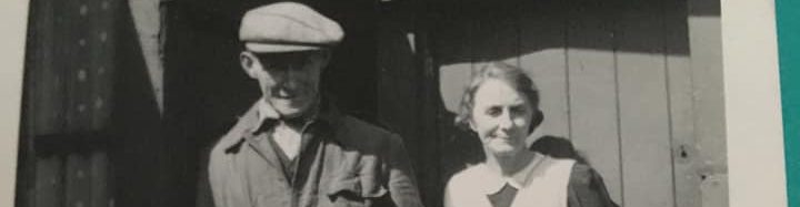
Billy Embleton
Backworth 1920 Chronicle Live

Backworth Post Office CC-BY Karl Pijnen

Havelock Place 1937- A lost Village when the adjacent pit closed down CC-BY Karl Pijnen

Havelock Place Location Map ©NLS

Backworth Main Street around 1900. © NLS
If anyone is curious on the purpose of the symbol in the fields, linking two plots of land together ( an S on its side) that is called a brace. The surveyor measuring the fields (for taxes) used it to combine fields together into one total acreage to save time. If you look at Castle Farm in the bottom left it had two ponds and they have been lumped into the total acreage of that plot, giving a total of 2.469 acres, the numbers in each field are the field / plot number for that parish and acreage. Map © NLS

The Wheatsheaf Inn Backworth
This was just off the south side of the main street OS Map 1841 ©NLS
SiteLines (HER 4495) mentions another public House and small brewery for sale in Backworth in 1838 at Northumberland Place, NZ430000 572400, the location given is well to the north of the existing main street.
Backworth Station 1977

© Billy Embleton / Flikr
Backworth – Dairy and Ivy Cottages
The Google images are a few years old, on a walk past in June 2025 you could see that the buildings roofs have collapsed and the decay is now advanced.
Dairy Cottage is Grade 2 Listed, Ivy is mentioned as having historical merit.
Planning Application 2018 – 18/01374/LBC

Map Location Dairy & Ivy Cottages © Google Maps

Dairy Cottage 2025 © WALHG

Dairy Cottage 2025 © WALHG

Dairy Cottage 2025 © WALHG

Dairy Cottage 2025 © WALHG

Dairy Cottage 2025 © WALHG

Rose Cottage 2025 © WALHG

Dairy Cottage 2025 © WALHG

Dairy Cottage 2025 © WALHG
Photos and a brief condition report on Daisy Cottage has been submitted to English Heritage, just to document the building condition in recent years. Rose Cottage is not listed and not on any register.

Backworth Two Images in Time 1910 & 2024

Top Image – © Google Maps 2024
Bottom Image 1910 © Newcastle Library Public Domian
The earliest reference, with other villages, seems to be in a grant by Henry II (1154-89) to Tynemouth Priory, and in 1189 two Backworths are mentioned. In 1292 Backworth was classed as possessing one of the priory’s 10 manors, and yet – in 1296 – both Backworths were small, each having only 4 taxpayers. In 1377 there were 10 assorted tenants, sharing 5 cottages, 1 bondage holding and some land, and by 1539 the 10 were all copyhold tenants, with identical holdings. Copyhold was a form of leasehold, with some stringent restrictions, the copy relates to the tenant having a copy of the entry made in the manorial register, not the actual deeds.
By 1650 the land to the north of the village had been divided up. The 19th century plans show an east-west 2-row village, with 2+ farms on the edge of the street, but a gap on the south side in front of the gardens of the 18th century Backworth Hall. Stone buildings still define the early village core, but beyond them mining has changed the village’s surroundings. Text TWSitelines
In 1870-72, John Marius Wilson’s Imperial Gazetteer of England and Wales described Backworth as – Backworth, or Blackworth, a township in Earsdon parish, Northumberland; on the Morpeth and Tynemouth railway, 4½ miles NW of North Shields. It has a station on the railway; which serves also for Holywell and Earsdon. Acres, 1,360. Pop., 954. Houses, 189. The manor belonged anciently to the priory of Tynemouth; and belongs now to the Duke of Northumberland. A coal mine here produces the Northumberland Wallsend or Earsdon Main coal.
West Backworth
A record from 1306 mentions both East and West Backworth. West Backworth is mentioned in a record in 1353, but disappeared before the records of Henry VIII’s Dissolution of the Monasteries 1536-1541, possibly losing its name during Tynemouth Priory’s estate reorganisation in the previous century.
All that is left of the village are subtle changes to the ground immediately to the south of Backworth Lane, visible from the air.
From these, archaeologists can see the vanished village once had a row of crofts along both sides of a street which ran east to west. Remains of the ridge and furrow system show the residents ploughed the arable land around them.
Information from https://localhistoryvideos.com/backworth-tyneside/
West Backworth Medieval Village
The Scheduled Monument includes both medieval earthwork and below ground remains and the remains of post medieval activity. Mostly underground and low-lying.
West Backworth medieval village is well preserved and the best example of an abandoned medieval village in Tyne and Wear. The wet conditions and the evidence of the unrecorded excavation indicate that significant information on the form and history of the village will be preserved beneath the present ground surface. The overlying ridge and furrow cultivation illustrates the abandonment of the village and its subsequent incorporation into the field system of the surviving Backworth village. The ridge and furrow cultivation is interesting and unusual as an example of open field agriculture laid out in or after the 15th century.
Details

West Allotment Medieval Village – Location on a modern map

LIDAR image of the site © Environment Agency

Backworth Medieval Village 1915 Map © NLS
The remains of West Backworth medieval village, 300m south east of West Farm, Backworth. The historic monument includes both medieval earthwork and below ground remains and the remains of post-medieval activity which overlie them in places. The surviving medieval remains include two rows of allotments (or crofts) aligned east-west along a hollow way. The hollow way bisects the field in which the monument is situated. The eastern section of the hollow way is 16m wide and 1.5m deep and leads to a post-medieval dammed pond. The section of the hollow way to the west of the pond is identified from aerial photographs and is the same width as the eastern section. The building platforms (or tofts) lying within the crofts are visible as level ground, which in the eastern half of the field is 1m-2m above the level of the hollow way. A further building platform in the south east corner of the field is 1m above the level of the other building platforms and 12m long by 8m wide.
An unrecorded excavation 20m south east of the pond has exposed surviving stonework in the north west corner of a 40m by 50m enclosure. The predominant post-medieval feature is the 5m wide ridge and furrow cultivation, which is orientated north-south and overlies all the medieval features. Post-dating this cultivation is the pond and causewayed track. The pond is approximately 10m in diameter and has been formed by the construction of a dam on its north side. The dam consists of an earthern bank 0.5m high by 5m wide and contains material of post-medieval date. The other post- cultivation feature is the causewayed trackway extending along the western half of the southern edge of the field. This trackway is 0.5m high and 4m wide. The earliest reference to the existence of both West and East Backworth was in AD 1189. In 1241 the two villages comprised a single manor which was granted to Tynemouth Priory. In the subsidy of 1296 the two villages were assessed separately, West Backworth providing four taxpayers.
The manor was devasted by Scots raiding in 1323. During the 15th century all the freeholds of both villages were extinguished, the lands went out of cultivation, and were subsequently divided into ten husbandlands *. By the 16th century West Backworth was deserted and its site was incorporated into the field system of East Backworth which now forms the present day village. The electricity pylons are excluded from the scheduling, although the ground beneath them is included.
© Historic England / Wrathmell, S, Deserted and Shrunken Villages in Southern Northumberland, 1975, PhD thesis
- Husbandlands – An old Northumbrian / Scottish term. the holding once held by a husband or tenant farmer or the quantity of land held by him
- Old English hūsbonda, from Old Norse hūsbōndi, from hūs house + bōndi one who has a household, from bōa to dwell
Between 1628 and 1664, Ralph Grey, a merchant from Newcastle, bought up 6 of the 10 copyhold farms in the township of Backworth and forced a partition upon the remaining four farmers. All land in the township was enclosed and Grey purchased the southern part of it. He built a hall there in 1675, which was
replaced by the current Backworth Hall in 1778-80, with formal and walled gardens and a well, which is also presumed to date to this period. (Archaeological Services 2014)

Backworth in the 1830’s Image NLS
Backworth 1844
Backworth in 1844. Interestingly B pit existed before what later became Eccles Colliery which is described as the ‘new winning’
Billy Embleton
Backworth 1920 Chronicle Live
Backworth Post Office CC-BY Karl Pijnen
Havelock Place 1937- A lost Village when the adjacent pit closed down CC-BY Karl Pijnen
Havelock Place Location Map ©NLS
Backworth Main Street around 1900. © NLS
If anyone is curious on the purpose of the symbol in the fields, linking two plots of land together ( an S on its side) that is called a brace. The surveyor measuring the fields (for taxes) used it to combine fields together into one total acreage to save time. If you look at Castle Farm in the bottom left it had two ponds and they have been lumped into the total acreage of that plot, giving a total of 2.469 acres, the numbers in each field are the field / plot number for that parish and acreage. Map © NLS
The Wheatsheaf Inn Backworth
This was just off the south side of the main street OS Map 1841 ©NLS
SiteLines (HER 4495) mentions another public House and small brewery for sale in Backworth in 1838 at Northumberland Place, NZ430000 572400, the location given is well to the north of the existing main street.
Backworth Station 1977
© Billy Embleton / Flikr
Backworth – Dairy and Ivy Cottages
The Google images are a few years old, on a walk past in June 2025 you could see that the buildings roofs have collapsed and the decay is now advanced.
Dairy Cottage is Grade 2 Listed, Ivy is mentioned as having historical merit.
Planning Application 2018 – 18/01374/LBC
Map Location Dairy & Ivy Cottages © Google Maps
Dairy Cottage 2025 © WALHG
Dairy Cottage 2025 © WALHG
Dairy Cottage 2025 © WALHG
Dairy Cottage 2025 © WALHG
Dairy Cottage 2025 © WALHG
Rose Cottage 2025 © WALHG
Dairy Cottage 2025 © WALHG
Dairy Cottage 2025 © WALHG
Photos and a brief condition report on Daisy Cottage has been submitted to English Heritage, just to document the building condition in recent years. Rose Cottage is not listed and not on any register.